Gas sensors take flight on UAVs
2017-09-25
Remote sensing of atmospheric gas concentrations is important in monitoring global greenhouse gas levels and industry monitoring. Monitoring is usually carried out via satellite sensing or laborious ground-based measurements.
With aerial measurement, a wider area can be measured efficiently, and repeat measurements taken of days, weeks and months gathering time-series data.

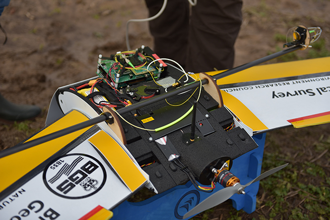
Custom drone with gas sensor (circled).
This spring, a study by QuestUAV and the British Geological Survey (BGS) used a custom QuestUAV Q200 airframe equipped with two sensors, one tuned for methane (CH4) and one for CO2. The sensors use an open-path gas mass spectrometer — a fiber-guided laser beam passed laterally across open atmosphere on top of the drone to a reflector and then back to the sensor itself.
Signals from the sensors were fed into a multi-core processing unit on board the drone. All readings were stamped with time and location provided by the standard GPS and flight units in the Q200.
The completed drone was commissioned in March. Over several months, trial flights were run over gas releases initiated manually on the ground over the test site. The recorded sensor data was processed immediately on return to base, and the data passed to BGS for analysis and appraisal.
The team plans to fine-tune the operational workflow and maintenance tasks for regular missions.


